Vegetation management: Overview

Written by Lane Cipriani
Updated at January 26th, 2023
Table of Contents
As a result of changing climate and weather patterns, and with the percentage of aging infrastructure in high risk areas, utilities are investing heavily and taking a holistic analytical approach to enhanced vegetation management.
Neara complements, and adds significant value to, the investments utilities have in their existing vegetation management systems.
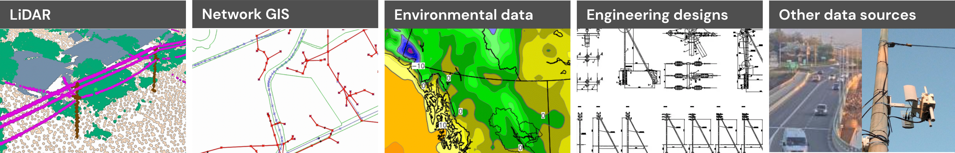
Once you have imported, normalized, and unified your data sources in Neara – such as LiDAR, network GIS, environmental data, engineering designs, and more – and constructed a network-wide digital twin that acts and behaves like the true assets in the field, Neara provides a holistic and analytical approach to enhanced vegetation management.
An end-to-end approach
Import, normalize, and unify data; and create the network model
Neara ingests, classifies, and builds a model of your entire network at scale. First we normalize, classify, correct, and unifying your data sources to construct a fully-editable, network model that acts and behaves like the true assets in the field:
Configuration
The Neara Project Delivery Team will configure your Neara workspace to match your network and vegetation management needs and processes during onboarding.
The articles in this section illustrate common vegetation management capabilities and usage in Neara. However there may be some differences between the features described and those configured for your network and business need.
We recommend that you contact your Project Delivery Team for guidance on using features specific to your organization.
Identification
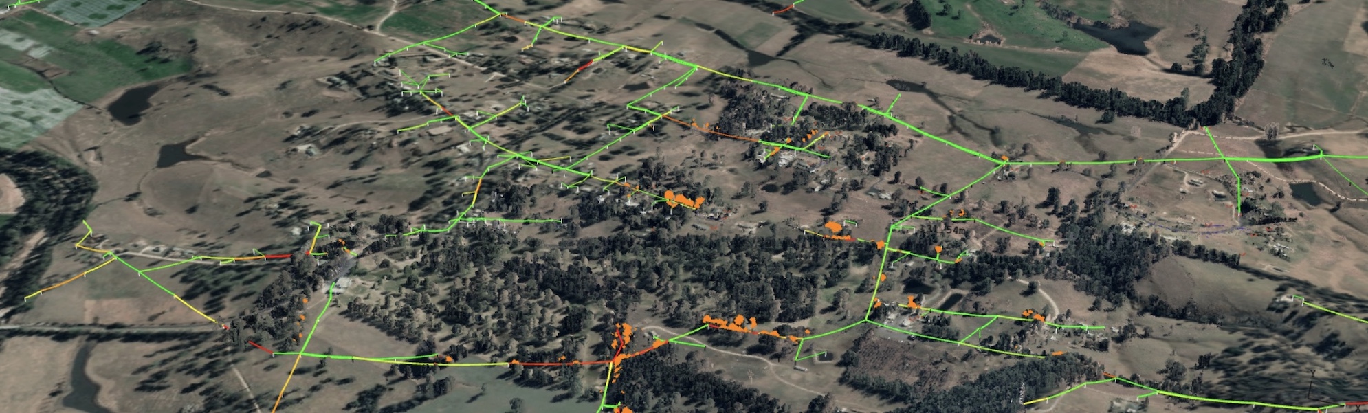
Neara provides standard/conventional clearance zones out-of-the-box that can be edited and iterated on. Neara can also reveal complex and hidden risks, including the ability to:
- Define encroachment zones by modeling blow-out, fall-in, and grow-in;
- Analyze worst-case scenarios and growth trends; and
- Estimate force and consequence of line-strike for each tree.
Explore: Vegetation management - Identification
Prioritization
Overlay the analysis done in various systems onto your Neara network model to:
- Understand where critical assets lie across your entire network;
- Prioritize spans based off vegetation encroachments to understand at scale where critical assets are located; and
- Make auditable decisions about where to allocate resources.
Explore: Vegetation management - Prioritization
Operationalize
Use Neara dashboards to eliminate pre-scoping requirements and unknown job sizes, maximize your understanding of what has to be done on site and nearby, identify where problems are grouped, and save a significant amount of trips to the field by:
- Understanding where work needs to be done;
- Understanding exactly what type of work needs to be done according to each permit or city; and
- Facilitating collaboration between crews in the field and project managers.
Explore: Vegetation management - Operationalize
Audit
Neara overlays recent satellite imagery, and can also overlay data from task management systems to:
- Highlight where jobs are about to be done, have recently been done, or have been audited;
- Eliminates the need to go on site to manually survey areas; and
- Enable significantly faster auditing and feedback for field teams.
Expore: Vegetation management - Audit