Step 3: Exporting classified LiDAR data

Written by Jannet Xiao
Updated at September 6th, 2023
Table of Contents
If you do not see these features in your Neara projects and would like to explore Automatic LiDAR Classification, contact our Customer Success team using the Contact Us link above; or if logged into the Neara app choose Chat with support from the Help menu
In Step 1 we showed how Neara makes it easy to import LiDAR data from your computer – or directly from connected cloud storage – using the the Point Cloud Importer panel.
In Step 2 we showed you how to rapidly and automatically classify LiDAR data using the Pipelines panel.
In this article, we show you how to export the newly-classified LiDAR data using the Exporter panel.
The Exporter panel
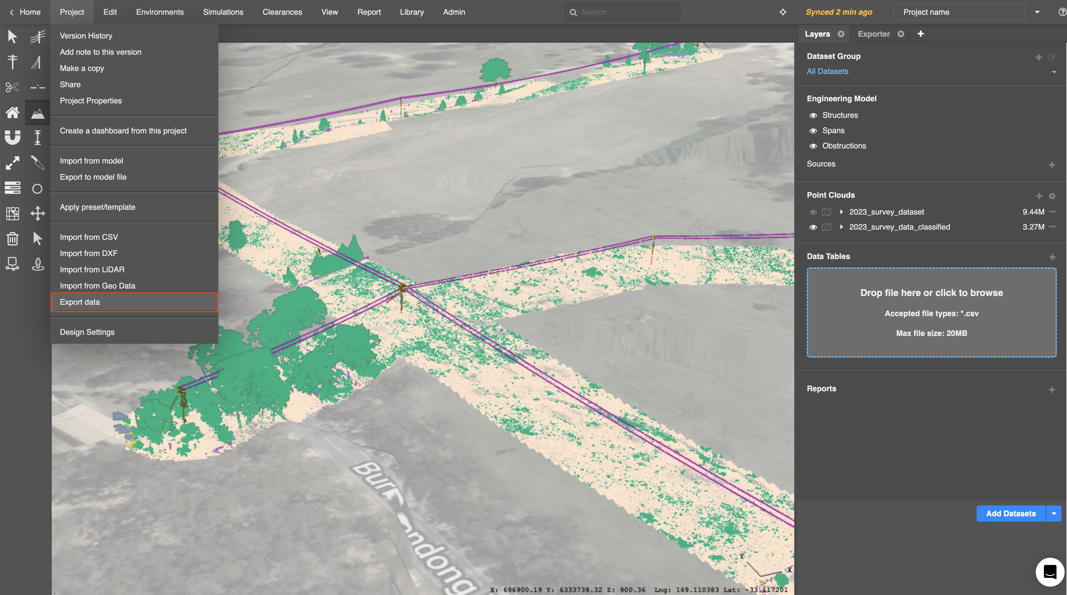
To open the Exporter panel, select Export data from the Project menu:
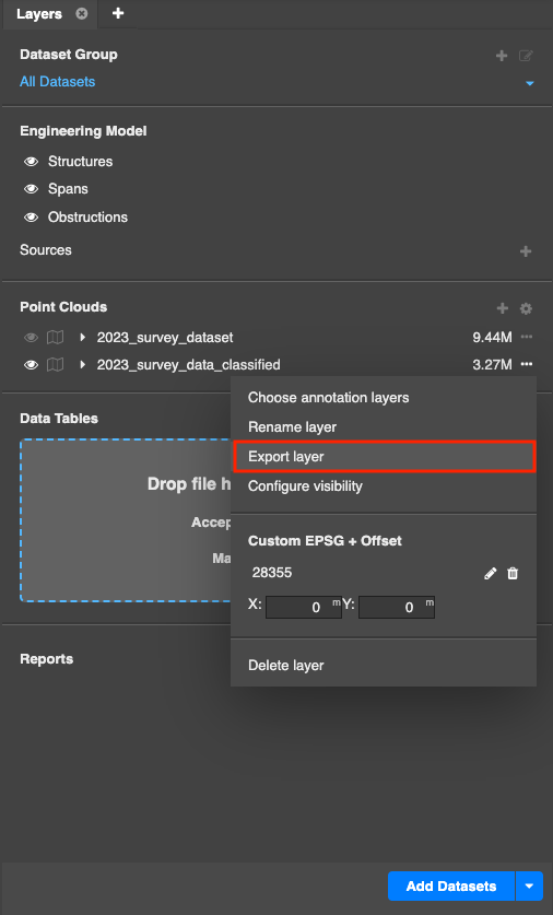
Alternatively, you can select Export layer via the context menu of the chosen dataset from the Layers panel.
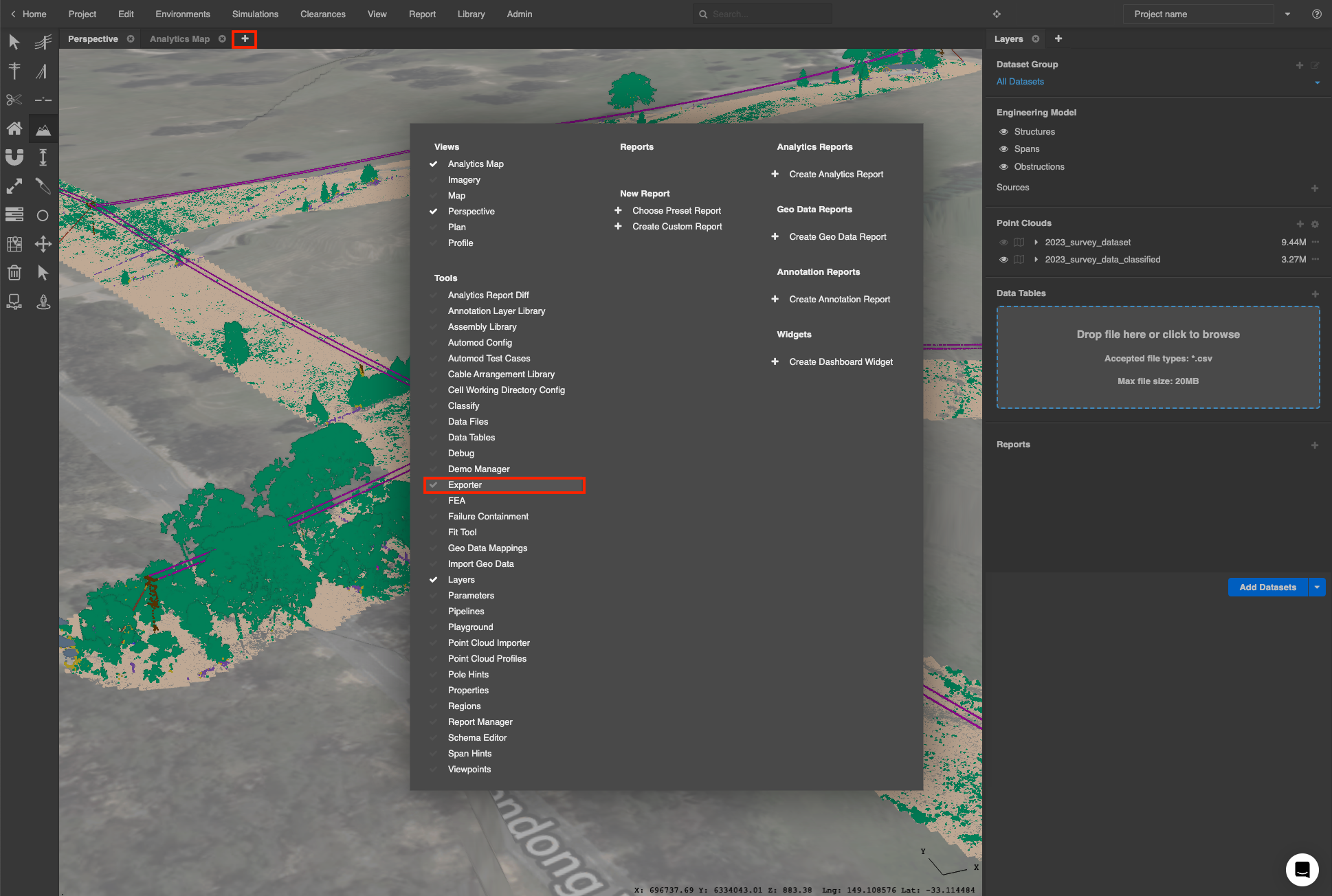
You can also click the (+) button at the right hand end of the tabs in any section of the workspace and select Exporter under the Tools section in the popup:
The Exporter panel will appear as shown below.
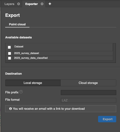
Set export options
Search through your datasets using the Available datasets table and check the classified dataset(s) you want to export, and enter a File prefix to name your export:
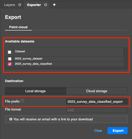
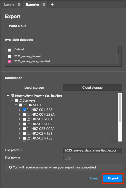
There are two destinations to which you can export LiDAR - your device or an external data source. If you have access to both sources, you can switch between them by clicking on the Local storage or Cloud storage tab.
If you are exporting to cloud storage, search through the folders in your cloud storage using the folder tree and select the folder you want to export to.

Exporting
Click Export to export the classified dataset from your project:
You will see an on-screen notification stating that your export has started and you will receive an email notification once your data export has completed, or if a problem has occurred.
As the user who performed the export, you will receive the email notification even you are not the owner of the project. Note that your export will be in a zipped format.
If you have opted to export to your device, a link to download your dataset will be included.

Exported data contents
The export will include:
-
The classified dataset(s) in LAZ format. More than one file may be produced, depending on the area classified
- Any per-point values for attributes such as timestamp, intensity, return number, and more that are present in the original data are retained in the exported point cloud files.
- A bounds.geojson file that contains the bounds of the dataset(s) exported
- A point-mapping.csv file that contains the point cloud classification code mappings that are present in the output
- An srid.json file that contains the SRID (EPSG) from the dataset(s)